
Athirappilly (Vazhachal)
A 24 m cascade and four hornbill species on the Chalakudy River
An Athirappilly waterfalls trip in Thrissur district pairs the roughly 24 m main fall with Vazhachal Falls, Sholayar forest and four hornbill species.
Overview
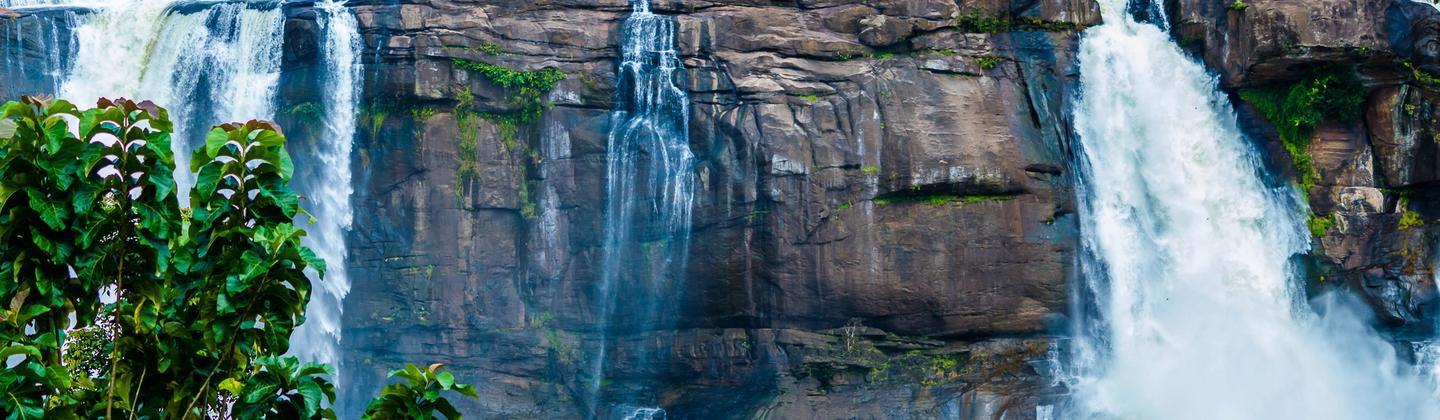
About 24 m high and roughly 100 m wide in the rainy months, Athirappilly Falls is the largest waterfall in Kerala. It lies in Thrissur district on the Chalakudy River, which rises in the Western Ghats, and it sits at the entrance to the Sholayar forest ranges. It suits day visitors from Thrissur or Kochi and bird watchers, and June to September shows the water at full strength.
Forest paths lead down toward the base of the main fall. The whole area falls inside the Athirappilly-Vazhachal forest range and ecotourism zone, so the visit is as much a forest outing as a waterfall stop. The surroundings count as much as the cascade. This is Athirappilly-Vazhachal forest, wet tropical country with tall trees and rocky cliffs, and the setting has appeared in many Malayalam, Tamil, Telugu and Hindi films since 1973.
Vazhachal Falls lies about 5 km from the Athirappilly entrance, at the edge of the Sholayar ranges, close to the Vazhachal Forest Division. It is a different kind of sight. Rather than dropping in a single curtain, the water slides along a rocky bed, and you watch from stone benches. The rocks there are very slippery, so stay on the permitted viewing areas and never step into the stream.
Nature interest runs beyond the water. These forests hold four endangered hornbill species, the only place in the Western Ghats where all four live side by side, which draws ornithologists and birders. Anyone who wants to look for birds rather than just the water should plan extra time under the trees. Thumboormuzhi Dam is another sight close by.
Because this is forest land, access conditions are set by the forest authorities and can change in the heaviest rain, so confirm that the falls are open before you leave. Entry rules, timings and fees are managed locally and are not repeated here.
Reaching the area takes some planning. The falls are about 30 km from Chalakudy railway station, about 53 to 55 km from Cochin International Airport and 59 to 63 km from Thrissur. By road from Kochi, allow around two and a half hours. Half a day is enough for the two cascades alone.
Known for
About 24 m high and about 100 m wide in the monsoon
Quick facts
Kerala's south-west monsoon, heaviest from June to August, gives the falls their strongest flow.
Cochin International Airport, about 53 to 55 km
Chalakudy Railway Station, about 30 km
About 2.5 hours by road from Kochi, 59 to 63 km from Thrissur and about 30 km from Chalakudy town. Other drive times to be supplied.
Keep to the marked viewing areas at Vazhachal, where the rocks are described as dangerously slippery
Check with the forest department that the falls and viewing paths are open before travelling in heavy monsoon weeks
Set aside extra time under the trees if birds interest you, as the area is known for four hornbill species
Location
Plan a trip to Athirappilly (Vazhachal)
Tell us your dates and we will shape the route.